

SENSORBITE P.S.A. (Poland) is one of the 8 winners of the COP-PILOT 1st Open Call. Their project, TURIA (Technology for Unified Radar Intelligence and Agent-based flood monitoring), is part of Cluster 2 (Smart Cities). We asked the team about their company, the challenge they address and the impact they expect.
Could you briefly introduce your company and describe its main activities?
SENSORBITE is a technology company developing AI-powered tools that turn complex data into clear, practical insights. We combine satellite imagery, connected sensors, maps, and other digital information to help organisations understand changing conditions and make better-informed decisions. Our work brings together artificial intelligence, Earth observation and geospatial analysis, with a focus on real-world challenges such as environmental monitoring, border control, infrastructure resilience and emergency preparedness. We believe advanced technology should be accessible and useful to the people who need it, not just to technical experts.
What challenge are you addressing under the COP-PILOT Horizon’s first Open Call, and how is your proposal relevant to the challenge?
Floods can develop rapidly, but the information needed to respond is often scattered across separate systems: weather forecasts, water-level sensors, satellite images, and local maps. This makes it difficult to see the full picture and act in time. The devastating floods in the Valencia region in 2024 highlighted just how important better preparation and coordination can be.
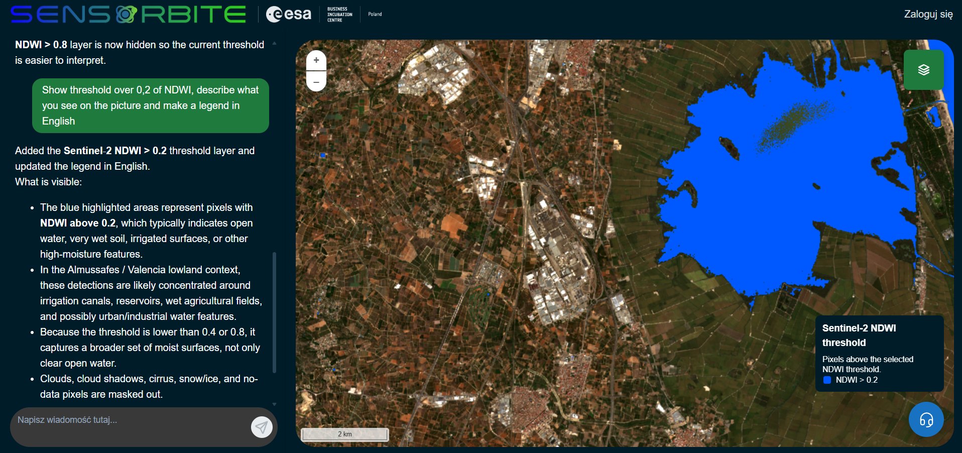
Through TURIA, we are developing an AI-assisted flood intelligence service that brings these different sources together in one easy-to-understand picture. It will help users explore changing conditions on a map, identify areas potentially at risk, and consider practical response scenarios, such as road accessibility and evacuation planning. Rather than navigating multiple technical systems, users will be able to ask questions in everyday language and receive clear, map-based explanations.
TURIA fits the COP-PILOT Open Call by demonstrating how connected sensors, satellite data, and European digital infrastructure can work together to address a real societal challenge. We plan to validate the approach in the Valencia/Almussafes pilot area, where the technology can be tested against realistic flood scenarios. The goal is to give emergency professionals better information, while keeping people firmly in charge of decisions.
What is the expected impact of your proposal?
We expect TURIA to make flood information easier to access, faster to interpret, and more useful when time matters most. Our goal is to provide users with clear, actionable insights supporting critical decisions within just a few minutes. Before a flood, authorities and infrastructure operators could use the service to explore risk scenarios and strengthen preparedness. During an event, shared maps, timely alerts, and clear situation summaries could help teams build a common understanding of what is happening and coordinate their response. Afterwards, satellite observations and other data could support damage assessment and improve future planning.
The wider benefit is a more connected approach to crisis management. Instead of relying on isolated sources of information, decision-makers would have a clearer picture that combines observations on the ground with a broader view from space. AI would help turn this complexity into accessible explanations and possible courses of action, without replacing professional expertise or human judgement. By testing TURIA in the Valencia region, we aim to demonstrate a solution that could later be adapted to other flood-prone areas in Europe, including Central and Eastern Europe. We also hope to show how European digital technologies can work together in practical, public-interest applications. Ultimately, our ambition is to help communities, public services and businesses become better prepared for extreme weather and more resilient to its impacts.